Well, that was an interesting experience. There was so much to it that I'm not sure I could ecapsulate it in a post, but here we go.
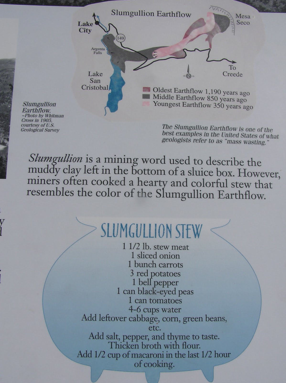
We are doing field work on the Slumgullion landslide in the San Juan Mountains of southwestern Colorado. This is in Hinsdale County, the least populated county in Colorado (790 residents) and one of the most remote areas in the lower 48 states. It is mostly wilderness with a handful of roads, approximately one of them paved. On our way to Lake City, the county seat, we first passed through South Park.

South Park is a grassy basin ringed by mountains. The setting reminded me of some of the landscapes in Lord of the Rings (which was filmed in New Zealand), but the name should remind you all of something closer to home, which is the culturally iconic TV series South Park. We stopped in the town of Fairplay, which is supposedly one inspiration for the series. Here I am riding a dinosaur at the Sinclair gas station:

I like this picture because the dinosaur and I seem to have the same expression (click picture for detail). I have since gotten a haircut, by the way.
Lake City (pop. 375) is a small town used primarily as a jumping-off point for hikers looking to scale many of Colorado's 14,000-ft. peaks, and as a vacation site for Texans. Nearly every car in town had a Texas license plate, and several of the town's handful of restaurants were BBQ (or other southern cooking) eateries. The town began as a silver mining camp in the 1870s, and used to house around 5,000 residents... you could say it's really gone downhill since then. Below, some shots of town:


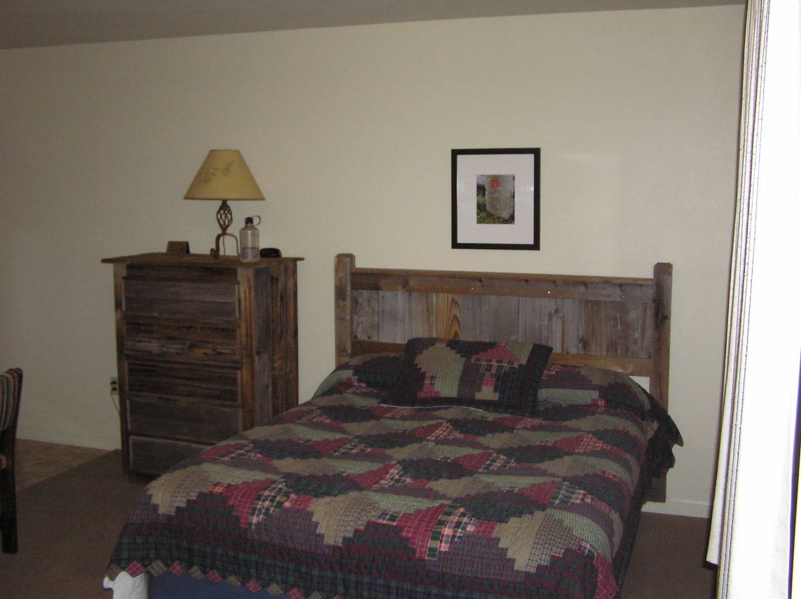
Above is the Matterhorn Motel, where we stayed. The neon sign in the middle of nowhere cracked me up. Here is my room:


...the best part being that giant picture of the three wolves. No moon, though.
I did not turn that TV on once because we worked from 7 in the morning until 7 in the evening, then went out for supper each night, and by the time I got back I needed to go to sleep.

Here we are on the landslide. This is an active landslide, meaning it is moving. It moves several meters a year. Part of my job this summer is to help set up the equipment to monitor its movement. You can see some of that equipment there on poles. One of the instruments is called an extensometer... it has a wire that comes out and is attached to another pole off the landslide. As the slide moves, the wire is pulled out further, and the movement recorded.
The thing that looks like a ditch running through the picture above is actually the fault separating the landslide (left) from older, inactive landslide deposits (right). The extensometers are set very high up because we don't want elk running into them.

To get the extensometers up so high, we need long poles. Here is my fellow intern carrying a 12-foot-long, 30-pound pole up the landslide from the road in the distance (click picture for detail). I also carried one of these poles most of the way up before I was relieved. Hauling the poles up was about as difficult as it sounds. This is certainly the most physically demanding job I've had, and at 10,000 feet of altitude it was hard to take more than a few steps without having to stop for another rest.
The workout with the poles was complemented by lots of digging holes with a hand auger (as in
this picture) to which we added sections of pipe as the holes got deeper. One hole reached about 20 feet, meaning that we had to pull 20 feet of pipe out of the ground every other minute to clear the clay from inside the auger bit. Into this hole was placed a piezometer, which measures water pressure.
Water pressure is important in landslides because higher pressure counteracts the effects of gravity and friction, which usually serve to keep soil in place. Many landslides occur during rainstorms for this reason. But also important to the Slumgullion slide are atmospheric tides. Our landslide moves only during the day, when atmospheric pressure is less due to solar heating.
Solar rays are also the cause of my not being able to feel my lower lip right now... I usually wear my fantastic Australian slouch hat in the field and so my face is in shadow for the middle portion of the day, but I took it off one day because the auger was dripping mud on my head whenever I hauled it out, and my head is easier to clean than my hat. I got so sunburnt on my lower lip that it is now numb. I must have killed all the cells. I'm going to need a prosthetic lip. (Yes, I have purchased lip balm with sunscreen for next time.) I also got burnt through my shirt one day. This is, I suppose, the combined effect of being out for 12 hours a day and working at an altitude where the protective atmosphere above me is much thinner.

This is Red Mountain, one of the many mountains visible from the slide. The slide itself is rather pretty, mostly yellow-orange with patches of white, grey, brown and purple. It is soft dirt with some rocks and boulders in it. All the rocks around here are volcanic, meaning they formed from lava that came out onto the earth's surface (as opposed to, say, granite, which cools from magma into rock below the earth's surface). It's often only the hottest magmas that make it to the surface to spew out as lavas, but the minerals that form in them are relatively unstable under the conditions on the earth's surface. This means that volcanic rocks break down much more easily than granite does, in some cases creating stunning landforms such as those of the nearby
Wheeler Geologic Area. (This area, which I do not expect to be able to visit, used to be a national monument, but it's so inaccessible nobody ever visited it, thus the demotion to its current rather bland name.)
A large section of the San Juan Mountains belongs to the La Garita Caldera. A caldera is the collapsed magma chamber of an erupted volcano, and the eruption in question, occurring about 28 million years ago, is possibly the largest eruption yet discovered on earth. It's hard to tell how much material was ejected, but it was about 5,000 times the amount erupted by Mt. St. Helens... more even than any eruption of the Yellowstone supervolcano, which has become more familiar to the public recently thanks to various TV programs. The La Garita Caldera is so huge, and has been reworked so much by other eruptions and resurgences, that it doesn't look like a crater, or much of anything. You can't see it by looking at Google Earth. Only a geologic study of the area reveals its presence.

Here is a picture of the headwall, or scarp, of the landslide... the surface at the top of the slide from which the material broke away. A very interesting feature here is a pond that stays in the same place as the landslide material moves into it and through it, carrying trees with it:

Here, the trees slowly slide down the hill and into the pond, where they die. The tree carcasses then are carried down the mountain side in a long line. Why does the pond stay in the same place while the landslide moves? There must be some sort of bowl or depression in the surface the landslide is riding over.
Among my few duties... which I am doing only the poorest job of describing... was riding these things:

If you click for a close-up you will see that the ATVs are labeled 1 and 2, prompting me to refer to them as Thing 1 and Thing 2. We used these ATVs to get up above the landslide scarp seen a couple pictures back, via a Forest Service trail, seen here in the distance:


A staged shot. While riding the ATV it was hard to do anything but focus on riding the ATV, which was not adjusted properly for the 12,000 feet we were now at. I had to keep it gunned, which felt kind of funny as we needed first gear most of the time, or it would die. If I had to stop I had to throw it into neutral and keep revving it the whole tome, or it would die. Most of the time the path was much steeper and rockier than what you see here. I had had about 20 minutes of practice on the road before we went up the trail, which was just about enough, though it was a challenge to immediately do something so demanding, especially since I'd never even handled a vehicle that required shifting before. If we can get the ATVs fixed for the altitude we will use them to carry equipment to the top, which would be a long and gruelling hike without them.
I don't have much to say about ATVing... I guess it was fun, mostly because it was challenging, but I would personally prefer mule packing. I can't think of a worse way to experience a setting like this...

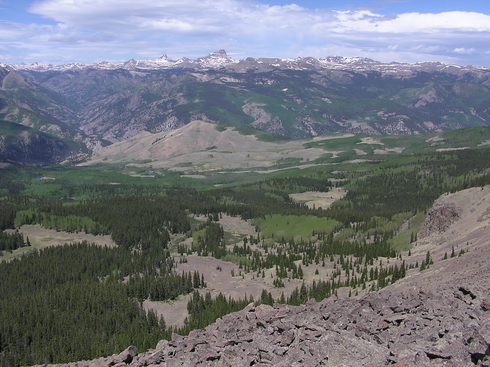
...than on a vehicle that requires too much concentration to look up from the path and makes so much noise there's no chance of seeing wildlife. The tallest peak in the picture, which is much more impressive in real life than in the picture, is Uncompahgre, one of the highest mountains in Colorado. In the other direction we could see what seemed to be Pike's Peak, which is something like 140 miles away.
We did see wildlife too, though, after we stopped and had a look around at the top. Spot the well-camouflaged rock ptarmigan in this picture:

It is changing from its winter to its summer plumage. Here is a pika, a relative of the rabbit:

My fellow intern saw a marmot. I have never seen a marmot, but here I am posing in my new Marmot gore-tex jacket that was on sale at REI:

Here is Lake San Cristobal, to which the name Lake City refers:

It was formed when the landslide dammed the Lake Fork of the Gunnison River. It is the second-largest natural lake in Colorado.
Below is a picture, taken from the top of the slide, of our supervisor standing on a 3-foot stepladder at the site with the lake. Click on the picture to see if you can find him. (Look for the dying trees!)

The top of the mountain we were on (which is named Mesa Seco, by the way) was very nice, but perhaps the most special moment occurred when my teammate tried to throw his banana peel off the edge. The massive updrafts of wind picked up the peel and tossed it into the air, over our heads, and about 100 feet behind us out of view. I fell over laughing. He found the peel and threw it again for me to record the results, though it's hard to see what's going on:
I don't know what else there is to say about my week in the field... it seems oddly dreamlike now. Working 12-hour days digging holes and carrying equipment up a mountain was certainly preferable to sitting in an office from 9 to 5 (though I am sure this would not be the case for all of my readers!). We'll be going back in a couple weeks and I am looking forward to that. I didn't feel sick at all out there, though have felt a little bit sick since returning to Golden... I don't know what that's all about.
The weather has not been so great here...

It had just hailed in town when we were getting back, and leaves, ripped from the trees, were all over the place, never mind the hailstones. Since then it has been rainy and in the 50s. I went for a hike in the rain today anyway, and there were some cows that wouldn't get off the path, but I am too tired to tell more stories now, so you will have to use your imagination about that.