
So, last month Sarah and I went backpacking on the Colorado Trail, making a loop from Jefferson Lake Road up toward Georgia Pass and back down the West Jefferson trail. This would be only the second backpacking trip I've done in the Colorado mountains; I am really not that familiar with them, and anyway each of the many ranges has different characteristics.
The mosquitoes were the defining aspect of the first part of our hike. I don't believe mosquitoes ought to exist in Colorado, as it's such a dry state, and it makes me especially angry when I get bitten by them here, even moreso when I can't stop hiking because ten of them latch onto me as soon as I stop.
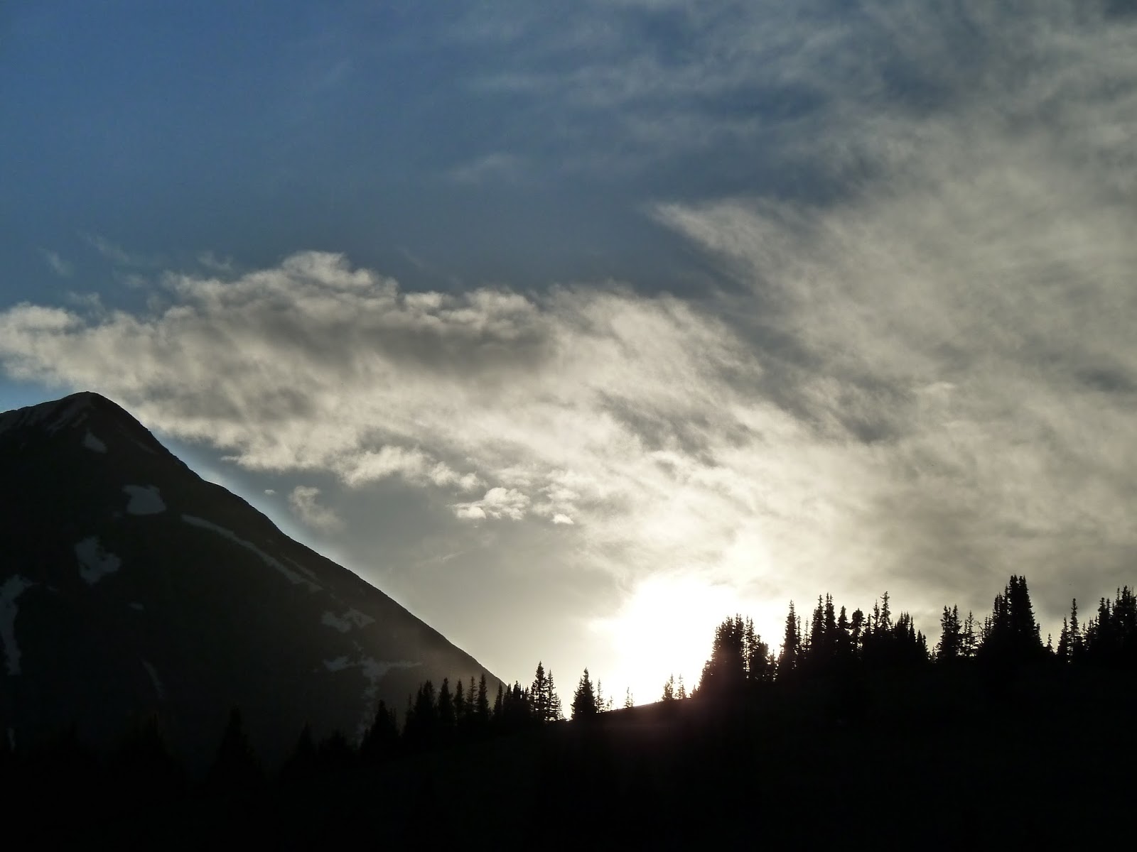
Thankfully the mosquitoes thinned out as we progressed up the trail, into a rainstorm and finally up to treeline around 11,500', where we set up camp and I took pictures of the sunset, wearing full rain gear to keep the remaining mosquitoes from biting.
11,500' sounds very impressive, but then the parking lot was at about 10,000'. I am still getting used to these things... sometimes I tell my Colorado friends stories about backpacking in the White Mountains of New Hampshire, where treeline starts around 4,800'. They do not believe this. "Why is it so low??" I don't know. The weather, I guess. Of course, the White Mountains have the worst weather in the country; also, the trails look like this:


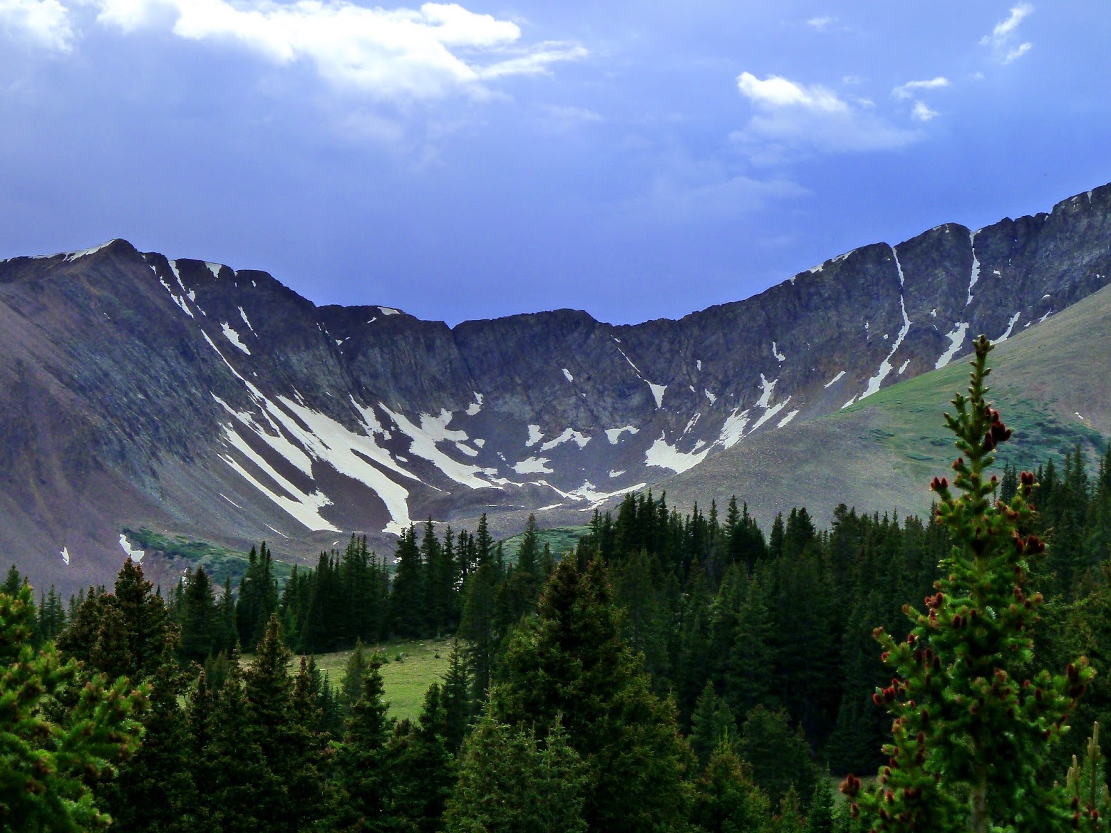
In the morning we continued on the Colorado Trail up to Georgia Pass, which sits on the continental divide. From here I wanted to climb that mountain in the picture above, Mt. Guyot, and return to our camp before setting off down the Jefferson Loop Trail the following day.
The frustrating thing about Mt. Guyot is that, while I could tell that it was climbable -- I was seeing people's trip reports on the web -- I could find no map of, or indeed even any mention of, a trail. Well, that's all right. Just look at it! It's not like you could get lost. Clearly you just keep putting one foot in front of the other and eventually make it to the top.
Shortly before reaching a junction with a four-wheel-drive road, we saw something large and white.


It was a cooler packed with lots of ice, and snacks and sodas for CT thru-hikers. We would meet several thru-hikers, including one man who was eating an entire package of fig newtons for lunch, and I could imagine that they would be very grateful to find this stash. Click on one of the above photos to read the comments on the cooler.
We began to climb the slopes of Mt. Guyot.

There was no trail. Instead, there were a lot of rocks. Tilty, pointy rocks. Other people were climbing up the rocks. A man and his toddler were climbing up the rocks, far above us. This seemed insane.


We climbed them for a while and then decided it was ridiculous, and that we should find something else to do. Mt. Guyot is ridiculous.

Here, Sarah walks down the mountain, with South Park visible in the distance. It was very windy by that point, enough to make me keep losing my balance. Are toddlers more or less susceptible to 40-mph gusts of wind than adults, do you think?
We had some candy and then walked out a ways on one of the four-wheel-drive roads, where these shots were taken:

Yes, that is Mt. Ridiculous in the background. And as it was starting to get stormy to the west we headed back toward camp, meeting some mountain bikers on the way, who took our photo together.

The storm arrived shortly after. Here is a picture of the hail landing outside our tent. I am going to stop taking pictures when I get hailed on in Colorado -- whether that is in a tent, in a raft on a river, or out for my afternoon walk at work -- because it has now happened to me so many times I feel it's losing its shock value.

Sarah decided to sleep through the precipitation. She slept for six hours. While she was sleeping, I wandered around taking pictures of things. Here is a picture of a log.

The rain stopped for a bit and we had dinner amidst the mosquitoes, and then I dragged Sarah out to the stream and took more pictures because I wanted to Do Something.


I forced her to take pictures with the sun behind her, which she believed would have the aesthetic appeal of high school yearbook photos. But look! I have turned her into a famous writer from the 70s. All she needs is a cigarette.

More photos:


And then we went to bed, and Sarah slept for a further 12 hours. I don't know why.
Then we hiked out. The West Jefferson Trail mostly had lots of trees, so I don't have any pictures from that. My last picture is from before we descended into the trees, of a bank of snow still remaining in late June, spawning tiny streams that were trickling down the slope to the pond below.

The final portion of the trip featured lots of mosquitoes. The end.
The next entry will be about our trip to Conundrum Hot Springs!
1 comment:
J, so glad to see you back! I have really missed your photography and your excellent wit! Looking forward to more whenever you post.
Post a Comment